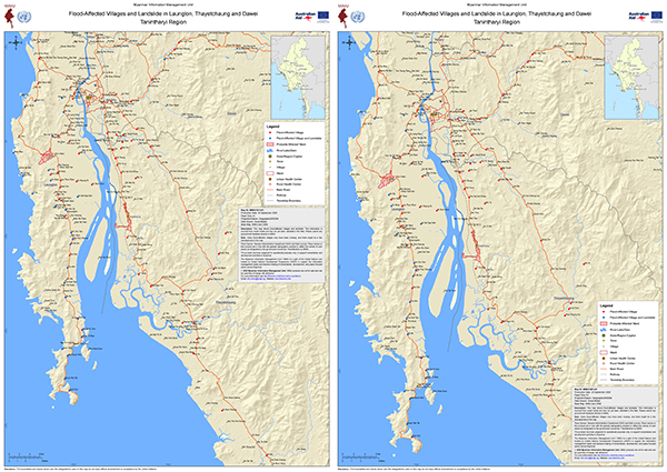
Heavy rain from 26 September caused severe flooding and landslides in Launglon, Thayetchaung and Dawei townships, with casualties and missing people reported. MIMU has mapped flood-affected villages, villages also hit by landslides, and probable affected wards in Dawei and Thayetchaung towns, with roads, the railway and health facilities. A first map was released on 28 September. An updated version on 30 September adds newly reported villages.
The maps are compiled from social media reports and have not been validated in the field. Ground feedback is welcome at [email protected].
Download the latest map (A1).
All flood-related resources.
News
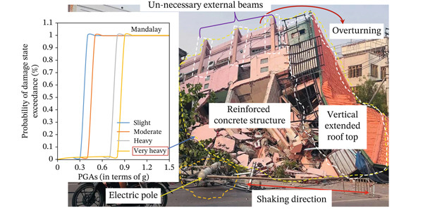
A new open-access study examines why buildings in Mandalay and Sagaing failed during the March 2025 earthquake, combining field inspections with structural modelling of six damaged structures: four reinforced concrete buildings, a masonry building and a temple. It identifies three main failure types: buildings overturning, failure where beams and columns meet, and complete collapse. The main causes were inadequate seismic detailing, insufficient reinforcement at joints, poor construction quality and non-compliance with the building code. Older unreinforced masonry structures such as temples were the most vulnerable. The study recommends practical measures, including proper seismic detailing, stronger joint reinforcement, retrofitting and reinforced masonry. These are relevant to anyone involved in reconstruction, shelter or infrastructure.
Published in The Scientific World Journal (open access).
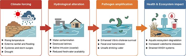
An open-access study examines waterborne diseases such as cholera and acute watery diarrhoea in Myanmar from 2021 to 2025. It combines health data with climate variables and a review of water and health policies. Cases peaked in the rainy season, and coastal and delta areas such as Rakhine and Ayeyarwady saw the most cholera cases. Fatality rates were higher in conflict-affected areas with weak infrastructure. Flooding appeared linked to outbreaks, but temperature and rainfall alone did not explain the patterns. The authors conclude that access to clean water and sanitation matters more than climate events on their own. They call for better coordination between the water and health sectors, stronger data sharing, wider local WASH services and climate-resilient planning.
Published in Water Research X (open access).
We’re currently processing data from the August 2026 round of the MIMU HDP Nexus 5W.
Starting next week, contributing organisations can request access to the Excel file (excluding restricted data) for strictly internal use.
Stay tuned for more products, including updated dashboards and maps, coming in the next few weeks! We would like to thank all contributing organisations for their active participation in this important exercise, and look forward to your continued cooperation and support in the next round of February 2027.
For queries, please contact our focal person at 09 7740 77761 or email [email protected].
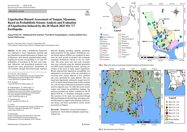
A new peer-reviewed study maps where in Yangon the soil is most likely to liquefy during strong earthquakes, using data from 154 boreholes. It also models conditions under the March 2025 Mw 7.7 earthquake. Low-lying, riverside and sandy areas show the highest risk, with potential ground settlement of up to around 0.7 m. The findings are relevant to urban planning, infrastructure design, and disaster preparedness in Yangon. Published in Geotechnical and Geological Engineering (subscription access).
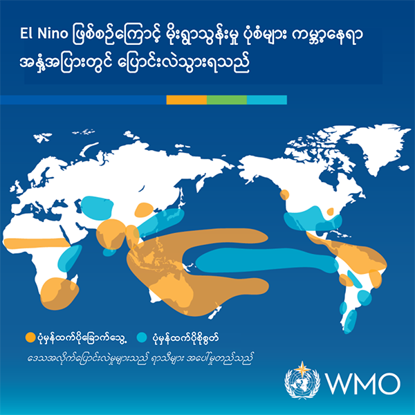
Seepuuyar has published a Myanmar-language translation of a United Nations University explainer on El Niño. It covers where the name comes from, how the phenomenon works, its effects on weather in different regions including Southeast Asia, and how climate change can intensify those effects. It’s a clear, accessible read for Myanmar-language audiences, and timely with a strong El Niño now under way.
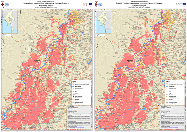
Flooding has continued along the Ngawun River in Ayeyarwady Region into September. MIMU has produced two new maps of Lemyethna, Yegyi and Thabaung townships showing satellite-detected surface water, both A1-sized:
- as of 11 September 2026 (6:00 AM)
- as of 13 September 2026 (6:15 PM)
Both maps carry the flood extent from 20 August alongside the September extent, allowing a direct comparison of how the inundated area has changed over the past three weeks. Both also show the embankment and the embankment breach site, together with village-level detail, main roads, railways, urban areas and health centres.
Both maps are available in English and Myanmar, sized for printing and field use.
Download from the Monsoon Flooding 2026 page on the MIMU website.
The Myanmar OpenStreetMap (myOSM) initiative was featured as UN Mapper of the Month for August 2026, recognising its work bringing the UN Maps Learning Hub’s open mapping materials into Myanmar language.
myOSM is a volunteer group of geospatial practitioners working across forestry, GIS, geography, remote sensing and open mapping. For the Learning Hub, the group coordinated the translation with a professional translator familiar with GIS terminology, then reviewed the content to keep OpenStreetMap and humanitarian mapping terms consistent, including working out Myanmar-language equivalents for technical concepts that have no widely accepted translation. They also tested the tools described in the materials to check the translated instructions matched what learners would actually see.
Read the full interview on UN Maps: https://maps.un.org/news/un-mapper-month-august-2026
More on open mapping in Myanmar: https://themimu.info/open-street-map
We are pleased to share a new Myanmar-language guidebook on writing proposals for humanitarian projects, developed by Metta Aid and shared for wider use.
Designed for practitioners in NGOs, and community-based organizations, the guide walks through each stage of proposal development, from analysing Myanmar’s funding landscape (MHF, ECHO) and writing conflict-sensitive problem statements, to building logframes, budgets, and risk registers suited to Myanmar’s operating environment. It also covers protection mainstreaming, MEAL in access-constrained settings, and donor engagement, with worked examples, templates, and a full sample proposal exercise.
The guide is available on MIMU's Call for Proposals page; a convenient place to browse current funding opportunities and strengthen your proposal in the same visit.
📥 Download the guide.
🔎 Browse open Calls for Proposals.
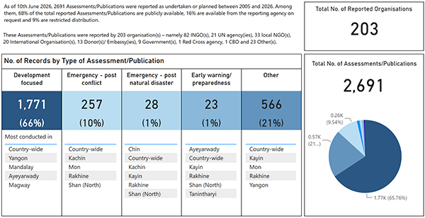
For this round, 18 new Assessments/Publications were recorded as of 10 June 2026, bringing the total to 2,691 records from 203 organizations. These are available through the MIMU Assessments & Publications Tracking page.
The updated MIMU Assessment Tracking Overview Dashboard can be seen through the link. Thanks to all agencies for your active participation in this exercise.
You are more than welcome to provide updated info of your planned and ongoing assessment at any time online through the submission page (You will need an account and if you do not have one, please contact us).
Please download and consult the guideline if you need any assistance or feel free to reach out to us.
- 1 of 22
- next ›