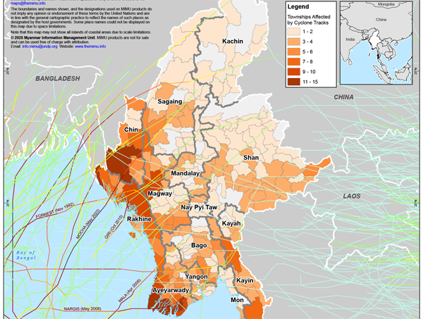
With the monsoon season coming soon along with the likelihood of tropical cyclones, earthquake recovery planning and management must be aware of potential impacts based on historical data, especially in areas already hit hardest by the earthquake.
MIMU has compiled storm track records for Myanmar dating back to 1960 and published a summary map. For those who wish to run their own analysis, create maps, or reference the data, the GIS layer that goes even further to 1842 is also available on the MIMU GeoNode platform.
Download the summary map.
Download the GIS layer for mapping.